Sunday, October 8, 2023

Yosemite National Park


I got the Yosemite bug, and simply had to drive up and see my most  favorite place. On the way up Highway 395,  I stopped at Independence Creek, where they have a great campsite on the creek. I've been coming here for over 10 years and each time, I am amazed by its beauty.
After Independence Creek I continued driving up Highway 395 and then stopped in Bishop Creek, where I stayed for a week. So amazing. My campsite was right here, right on the water. I love hearing the sound of the creek rolling by. Never get tired of it.
After finally making it to Yosemite, I stopped at the river to take a selfie!
My campsite was in a Forest Service campground outside of Yosemite National Park, just a 10 minute drive to the entrance, with this unbelievable view!
It rained a lot in the afternoons and evenings at Yosemite. However, I have a bed made up in the back of my Subaru so I stayed dry. After it finally cleared and the evening sun broke through, I leaned out of my car and took this picture of the tangerine clouds and dark trees above my head.
The following morning, with a deep feeling of expectation, I drove up to Yosemite National Park. Everything was just as I remembered it to be. Clear, cold water, trees  and to my surprise, golden reflections in the still water near the road. Immediately I felt peace, just like I did long, long ago when as a child I first camped in Yosemite with my Aunt Dorothy, siblings and cousins. 
Cruising through the park, I stopped at Lembert Dome, located in the high country of Yosemite. This huge granite slab rises 800 feet above Tuolumne Meadows for a total elevation of over 9000 feet high. At one time in my life I hiked to the top, which for me was a very difficult hike. My first try failed and years later I hiked up with a ranger and made it to the top! That won't be happening now!
This trip I took the hike in Tuolumne Meadows which leads up to Lyell Canyon. It connects with the PCT and later on the John Muir trail, neither of which I have completed! 
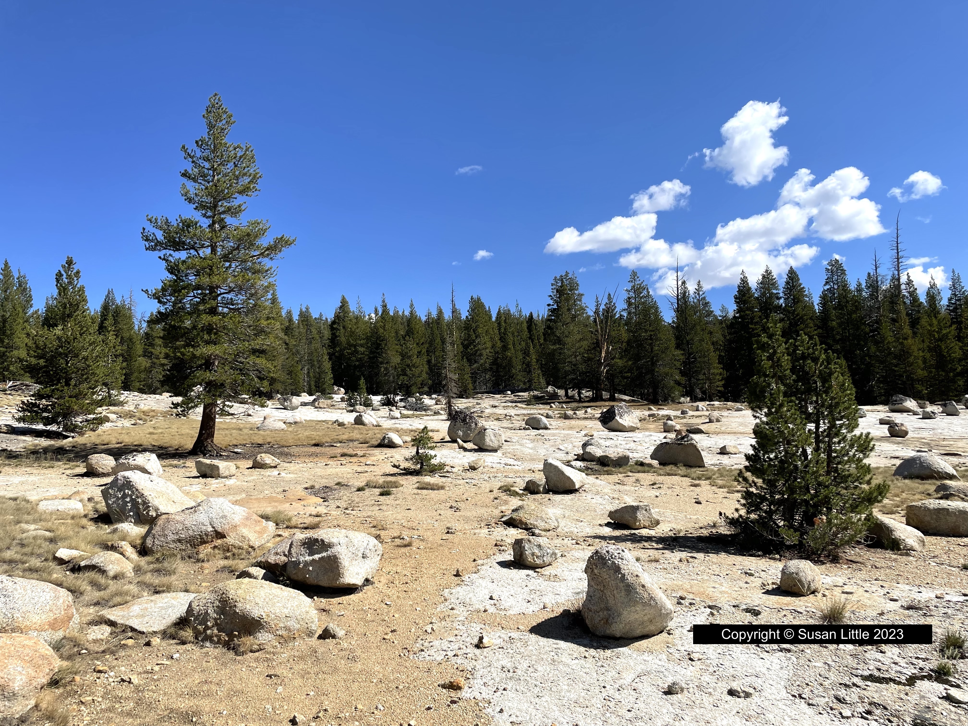
I passed this boulder field and was fascinated by how different it looked from the surrounding area. It felt like I had been transported to the moon.
To me, this is Yosemite. Clouds, trees, mountains and water. It doesn't get much better than this.
A pothole along Lyell Creek. Whenever I see these pictures it makes me want to go back and camp in Yosemite. Then I remember how cold it was in the morning, 35 degrees, and how I couldn't even light my stove as my hands wouldn't work. 
One little purple flower, growing so strong and graceful in the morning sun.
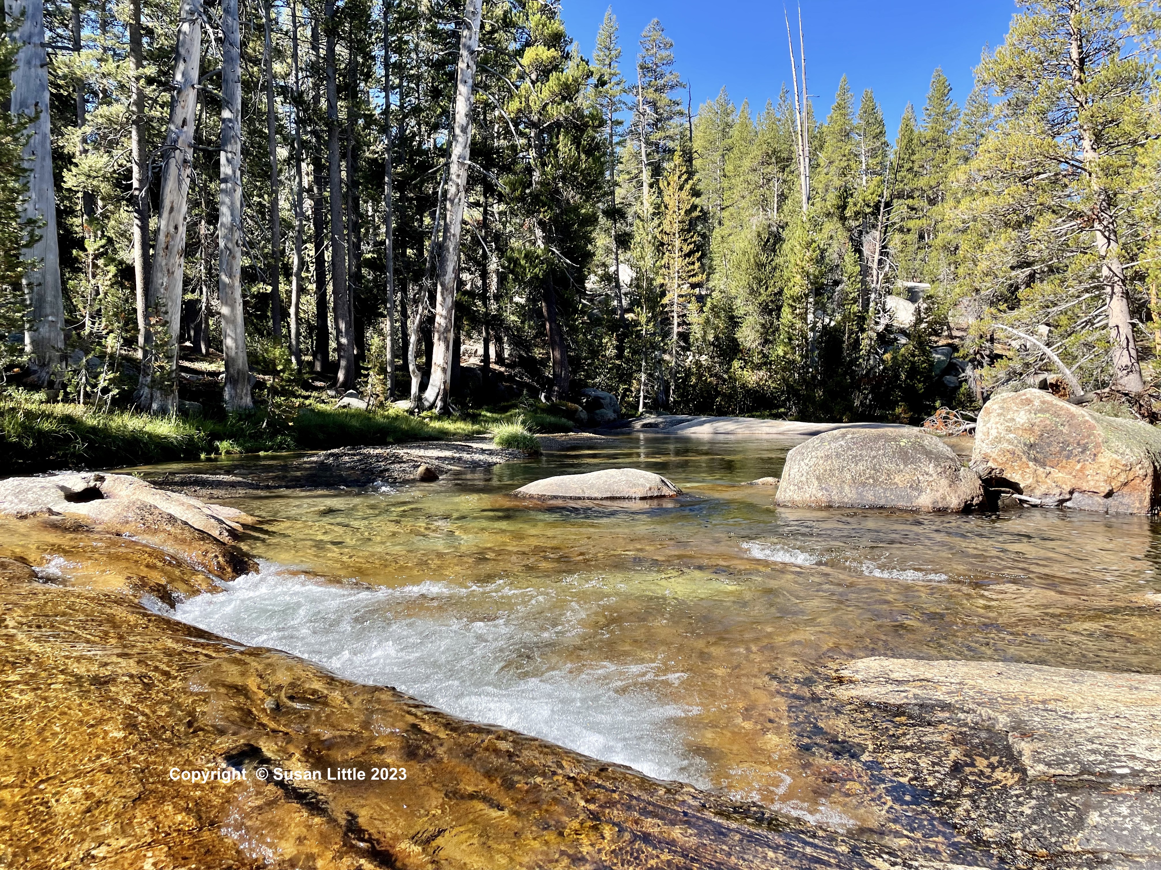
A swimming hole in Lyell Creek beckons me. As a younger more courageous woman,  I would have jumped in and swam around for 30 seconds. Now, I just look and take pictures!
Looking past the purple lumen, you can see clear to the bottom of the creek. The clouds and trees are reflected in the clean water.
On my way home from Yosemite National Park, I stopped at the Lone Pine Visitor Center and took this picture from the parking lot. In the distance you can see the Sierra Nevada Mountains with Mt Whitney on the far right. Mt Whitney rises to an elevation of 14,505 feet.  I admire anyone who has had the guts and the stamina to make it to the top. Blessings to you and yours! May your days and nights be filled with beauty, peace and God's great love. Susan Little

Saturday, June 17, 2023

Burney Falls State Park, Oregon


Last month I flew up to my sisters house in Pollock Pines to share in the reunion of three of us sisters, my brother in law and my cousin. It was quite the trip! My older sister Judy and her husband Tom, hosted us for the event. After resting from our flight out to Judy's, we drove to Oregon to connect with our cousin. Along the way we stopped at Burney Falls State Park to hike and see the falls.
As we hiked down to the falls, we passed such beautiful greenery. The mist from the waterfall sparkled in the sunlight on these green leaves.
As an artist, I always appreciate the natural world, with all of it's color, shape and textures.
The trail down to the base of the falls  had several very good viewpoints along the way. At this point, green leaves, brush and foliage frame the rushing waterfall. 
The view from the base of the falls is the best! Burney Falls State Park is surrounded by gorgeous mountain peaks and steep, rugged cliffs.  Countless trees and plants grow within the park. The volcanic origin of the park can be plainly seen in the volcanic rock covering the ground and cliffs. 
Burney Falls is a 129 foot waterfall that doesn't just run over the cliff, but exudes through the cliff walls. The layered, porous basalt retains the rainwater and the snow melt and forms a huge underground reservoir. 
Above the waterfall, the reservoir of ground water emerges through the ground as springs of water that rush down and through the cliff at 100 million gallons of water every day.
That would be me on the left sitting in front of the waterfall with my forever young sister Dorothy.
A sign near the falls explains how Burney Falls was named after a pioneer settler, Samuel Burney who lived in the area in the 1850's.The descendants of the pioneer settlers to this area were responsible for saving the waterfall and land from development. They bought the property and gave it to the state as a gift in the 1920's. I so appreciate those people and others like them,  who think ahead and save our natural places for all to enjoy.
My sister Judy and cousin Chris out near Chris's house in Oregon.
The four girls at the hotel. What fun to all be together again!
The meandering Lost River, bordering Chris's property. I've been told that it was named the Lost River, because it meanders like crazy, at times disappearing underground.  Sort of like us girls. Always lost, always amazed by what we see and where we end up, and always glad to be together.
We drove by Mt. Shasta on the way home and marveled at its beauty.
Weed, California is a small town that is very close to Shasta. I would have liked to meet the person who made this old building and set those rocks in place.
On our last day with Tom and Judy we decided to take a drive out to Lake Tahoe. The road to Tahoe, Highway 50, was open, so we jumped at the chance to drive along the American River. At Tahoe we ate delicious hamburgers and much to my dismay,  I fell flat on my face right onto the concrete. We never even made it to the lake! A sad way to end a very fun trip.  Needless to say I cried my eyes out, my family cared for me, and I was able to fly home the following day and treat my numerous injuries with my own doctors. Life is looking up again, and I am feeling better. I do love and appreciate my family,  and thank God every day for my precious family and friends. Adios!

Copyright©2009 Susan Little, thecampingqueen72@gmail.com. All rights reserved. Use of photos requires written permission.

I do not accept comments or advertising on my blog, but feel free to email me.